DOKORI, Redesigned.
Since its launch in 2022 and a previous update in February 2024, DOKORI has undergone a major redesign.
While the core functionality of searching and browsing terrain information remains, this update introduces many new features — most notably online map purchasing — along with a completely refreshed design. Here's what's new.
1. Online Map Store
The biggest new feature is the ability to purchase and download orienteering maps online.
Previously, getting an O-Map typically involved attending a competition or arranging purchases via email and bank transfer. On the new DOKORI, you can browse, purchase, and instantly download maps directly on the site.
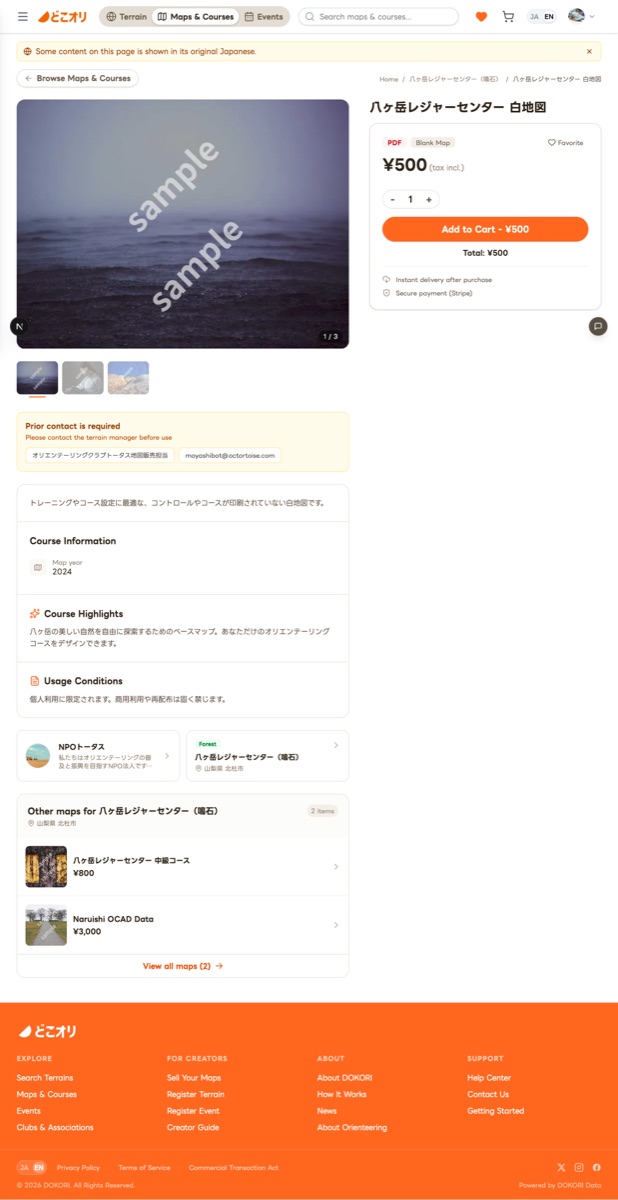
For Map Buyers
- Purchase blank maps, course maps, OCAD data, and more in various formats
- Pay securely by credit card and download immediately after purchase
- From a terrain's detail page, see all available maps for that terrain at a glance
For Map Creators
- Create a creator account on DOKORI and register your maps for sale
- Open to everyone — from individual mapmakers to clubs and organizations
- Track sales on your creator dashboard and request payouts
We hope this makes it easier for everyone to share and discover orienteering maps.
2. Design Refresh & Mobile Experience
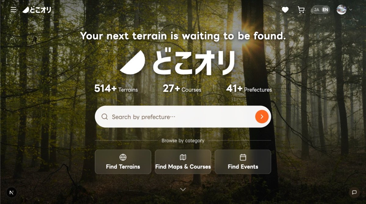
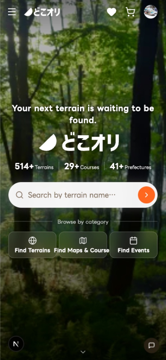
The entire site has been redesigned. The homepage hero section now features the tagline "Your next terrain is waiting to be found" alongside stats — 514+ terrains, 27+ courses, and 41+ prefectures — plus clear category navigation to terrains, maps, and events.
The biggest improvement is the mobile experience. Previously, the mobile layout was essentially a scaled-down version of the desktop design. This time, we designed the mobile layout from scratch — terrain search, terrain details, product pages, and event listings are all optimized for comfortable use on your phone.
3. Enhanced Terrain Detail Pages
Terrain detail pages have received a major upgrade. They now follow a three-phase structure — Inspire → Guide to Action → Detailed Data — designed to match the natural flow of user interest.
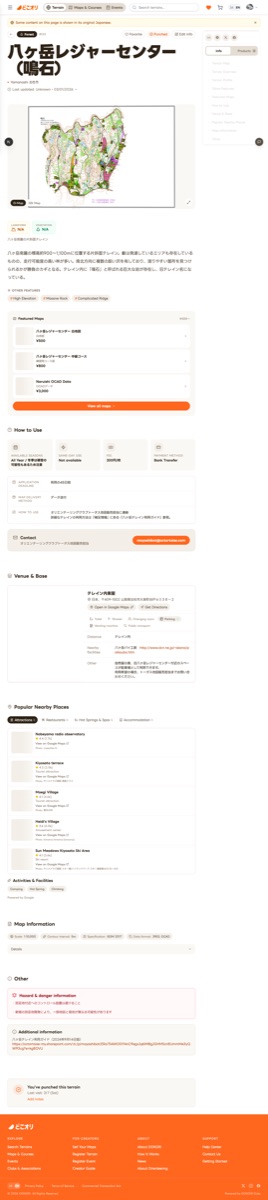
- O-Map / GSI Map tab switching — Tap the map to view it full-screen
- Recommended Maps section — Purchase maps for the terrain directly
- Nearby Popular Spots — Tourist attractions, restaurants, hot springs, and accommodation shown automatically. Easily see where to visit alongside your training
- Usage, contact & venue info — Terrain rules, contact details, and venue amenities at a glance
4. Map-Based Terrain Search
The terrain search page now features a new map view mode. All terrains across Japan are plotted on an interactive map, letting you intuitively find terrains by tapping on areas that interest you.
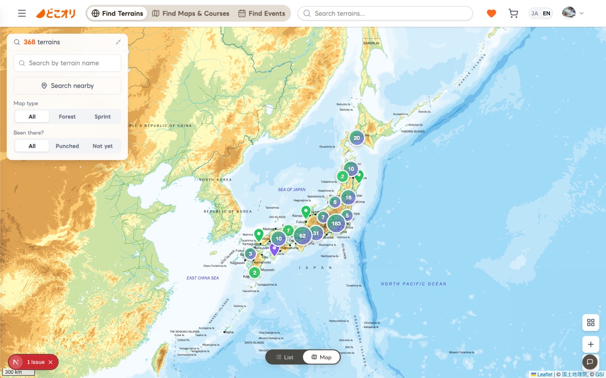
- List and map view toggle — Switch between list and map view with one tap
- Search from current location — Find terrains near you using your device's location
- Filters for map type, scale, contour interval, and more are also available
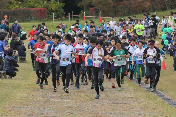
5. Punch — Record Your Journey
In orienteering, runners punch at each checkpoint to prove they were there — it's the ritual at the heart of every course. On the new DOKORI, we've brought this ritual into the digital world.
Terrains you've visited, maps you've collected, events you've joined — punch each one and build your personal orienteering history. Your profile page shows all the terrains you've punched at a glance.

6. More New Features & Improvements
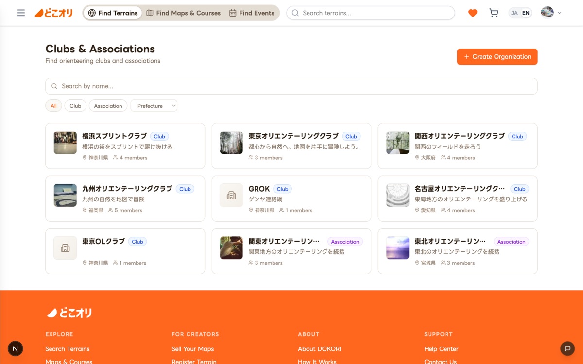
Organization (Club) Pages
A new section for browsing orienteering clubs, prefectural associations, and other organizations. Each organization page shows the terrains they manage, maps they sell, and events they host — all in one place. We're building a foundation where organizational communities can grow. "Looking for a club? Start here."
Improved Registration
Registering terrains, events, and map products is now more intuitive. Key improvements include:
- Server-side draft saving — Your work is saved to the server, safe from browser crashes
- Image uploads — Upload terrain photos and O-Map images directly
- Draw outlines on the map — Draw terrain boundaries directly on a Leaflet map
- AI Translation — Automatically translate Japanese entries into English
For details, see the Terrain Registration Manual.
Favorites
Save terrains and maps you're interested in to revisit later. Works even without logging in — and syncs automatically once you do.
Bilingual Support (JA/EN)
The entire site is now available in both Japanese and English, welcoming orienteers from around the world.
Thank You for Using DOKORI
The new DOKORI introduces online map purchasing alongside the terrain search and browsing you already know. We'll continue to improve the platform for both map creators and orienteers.
We welcome your contributions — whether it's registering terrain information or listing maps for sale. If you have questions or feedback, please don't hesitate to contact us.
Ready? Let's find your next terrain.